



Do You Know What Cadastral Means?, Posted on October 8, 2026
Do You Know What Cadastral Means?, Posted on October 8, 2026
I encountered the word “cadastral” while researching a huge map that hangs on the wall opposite my desk at the Scott Family Collection. Its an odd word and one I had never seen before.
According to the Merriam-Webster Dictionary, cadastral “is an adjective that means of, relating to, or showing the extent, value, and ownership of land, typically for the purpose of taxation or legal documentation.”
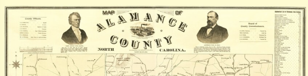
The map in my office was prepared by William Luther Spoon who knew a lot about surveying and road building. It was published in 1893. The map shows geographical features plus items of the built environment such as railroad lines and roads. And it includes the location and owner of properties scattered around the county.
At the top of the map there are three engraved images: a bust of then Chief Justice of the NC Supreme Court Thomas Ruffin, a drawing of the Oneida Mills, owned by one of Governor Holt’s brothers, and a bust of then Governor Thomas Holt.
The Scott Family Collection has two versions of this map. The larger one is in black and white. The smaller one has the various townships colored in, so you can see the boundaries.
Alamance County was carved out of the western side of Orange County in 1849. The new county seat was named Graham. The new town was organized into roads leading away from the courthouse square.
An early founder of Graham was John Scott, son of Samuel Scott and brother of Henderson Scott of the Hawfields. John must have felt a lot of loyalty to his home church however, as after his death he was buried in the graveyard of Hawfields Presbyterian Church, his home church. He was proud of his contributions to Graham however. On his tombstone we find the words: John Scott of Graham.